Monsoon onset over Kerala was delayed by 8 days. Soon after, Cyclone Biperjoy stalled the progress of the monsoon over the south peninsula and further into northeast India. June ended with a rainfall deficit of 10%.
In the last week of June, the monsoon advanced rapidly and covered the entire country on July 2, much ahead of schedule. A persistent low pressure area and depression developed over west central Bay of Bengal and moved inland. Heavy rain was witnessed in parts of Rajasthan, Gujarat and Mumbai.
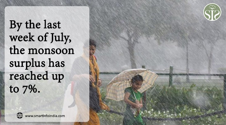
Monsoon rains remained high during July. Monsoon surplus reached 7% in the last week of July. The ongoing rain activities over the northwest and central parts of the country have reduced considerably during the last 10 days. The 7% surplus has now been consumed. Going forward, we expect monsoon rains to turn negative.
The effect of El Nino will be seen during August and September. The axis of the Monsoon trough has shifted towards the foothills of the Himalayas, causing obstruction in the Monsoon conditions. We do not expect any significant rain activity over Northwest Central and South Peninsula for at least next week. There is no sign of any significant development over the Arabian Sea or the Bay of Bengal. This is a matter of concern for many states in the North West, Central and South Peninsula.
Models are indicating a positive IOD during the second half of August and September. This can reduce the harsh effect of El Nino to some extent. Monsoon is looking very likely to end with below normal rainfall.